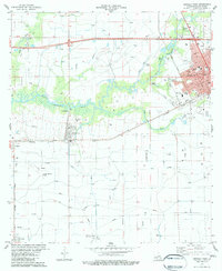
1983 Map of Crowley West
USGS Topo · Published 1983About this map
Crowley and its immediate western prairies are defined by the intricate water management systems of Acadia Parish in the early 1980s. The landscape is a lattice of flumes, canals, and pumping stations designed to support the region's agricultural output, with Bayou Plaquemine Brule and Tortue meandering through the southern and central sections. Transportation and commerce center on the Southern Pacific railroad corridor, which links the established settlements of Estherwood and Midland. Within Crowley, the map details municipal developments like Hoffpauir Park and educational landmarks such as the SW Louisiana Voc-Tech Sch. To the south, aviation infrastructure is prominent at Le Gros Memorial Airport and the smaller Lewis Landing Strip. Local history is preserved in smaller sites like Leger Cem and Boussard Park Cem, providing essential points of reference for genealogists tracing family roots in this corner of the Cajun heartland.
Find a feature on this map
34 named features on this map. Tap any name to fly to it.
Don’t see what you’re looking for? This feature index may not catch every label — zoom into the map to look around manually.
Map Details
Editions of this 1983 Crowley West Map
2 editions found
Other maps of this area

1935 · Branch
USGS Topo · 1:31,680

1946 · Morse
USGS Topo · 1:31,680

1946 · Mermentau
USGS Topo · 1:31,680

1946 · Kaplan
USGS Topo · 1:31,680

1946 · Rayne
USGS Topo · 1:31,680

1947 · Evangeline
USGS Topo · 1:31,680

1947 · Branch
USGS Topo · 1:31,680

1947 · Iota
USGS Topo · 1:31,680

1949 · Gueydan
USGS Topo · 1:31,680

1949 · Estherwood
USGS Topo · 1:31,680