
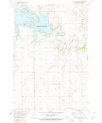
1980 Map of Crown Butte Creek NW
USGS Topo · Published 1980About this map
Crown Butte Creek meanders through the high plains of the North Dakota badlands, carving a path across the border between Morton Co and Grant Co. The landscape is defined by the elevation changes of the Ramsland Hills and an extensive network of drainage basins. Human activity in this rural stretch is marked by scattered infrastructure, including a prominent Landing Strip in the northern reaches and several Wells dotting the terrain. The presence of a named Spring in the southern portion of the sheet highlights the importance of water sources in this semi-arid region. This 1980 edition captures the character of the western Dakotas after decades of ranching and early energy exploration, showing the intersection of natural topography and sparse, functional development.
Find a feature on this map
6 named features on this map. Tap any name to fly to it.
Don’t see what you’re looking for? This feature index may not catch every label — zoom into the map to look around manually.
Map Details
Editions of this 1980 Crown Butte Creek NW Map
This is the sole edition of this map. No revisions or reprints were ever made.
Other maps of this area

1938 · Heart Butte
USGS Topo · 1:48,000

1944 · Heart Butte
USGS Topo · 1:62,500

1954 · Bismarck
USGS Topo · 1:250,000

1958 · Bismarck
USGS Topo · 1:250,000

1960 · North Almont
USGS Topo · 1:24,000

1960 · Dengate
USGS Topo · 1:24,000

1960 · Glen Ullin
USGS Topo · 1:24,000

1960 · Heart Butte
USGS Topo · 1:24,000
1980 · Lake Tschida East
USGS Topo · 1:24,000

1980 · Crown Butte Creek SE
USGS Topo · 1:24,000