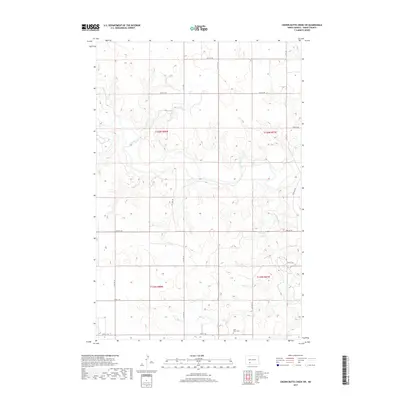
2017 Map of Crown Butte Creek SW
USGS Topo · Published 2017About this map
The Heart River winds through the southwestern corner of Grant County, cutting a path through the high prairie landscape near the border of t135n r88w and t135n r87w. This terrain is defined by the gradual drainage of the river basin, which provides the primary geographical break in a region otherwise dominated by the section lines of North Dakota's vast agricultural grid. Evidence of early settlement and community centers is sparse, anchored primarily by the Saint Johns Cem located in the southern reaches of the quadrangle. This local landmark, situated along 63rd St SW, serves as a critical point of reference for genealogists and local historians tracing the families who farmed these sections in the early twenty-first century.
Find a feature on this map
21 named features on this map. Tap any name to fly to it.
Don’t see what you’re looking for? This feature index may not catch every label — zoom into the map to look around manually.
Map Details
Editions of this 2017 Crown Butte Creek SW Map
This is the sole edition of this map. No revisions or reprints were ever made.
Other maps of this area

1938 · Heart Butte
USGS Topo · 1:48,000

1944 · Heart Butte
USGS Topo · 1:62,500

1954 · Bismarck
USGS Topo · 1:250,000

1958 · Bismarck
USGS Topo · 1:250,000

1960 · Heart Butte
USGS Topo · 1:24,000

1980 · Crown Butte Creek NW
USGS Topo · 1:24,000
1980 · Lake Tschida East
USGS Topo · 1:24,000

1980 · Crown Butte Creek SE
USGS Topo · 1:24,000

1980 · Heil
USGS Topo · 1:24,000

1980 · Crown Butte Creek SW
USGS Topo · 1:24,000