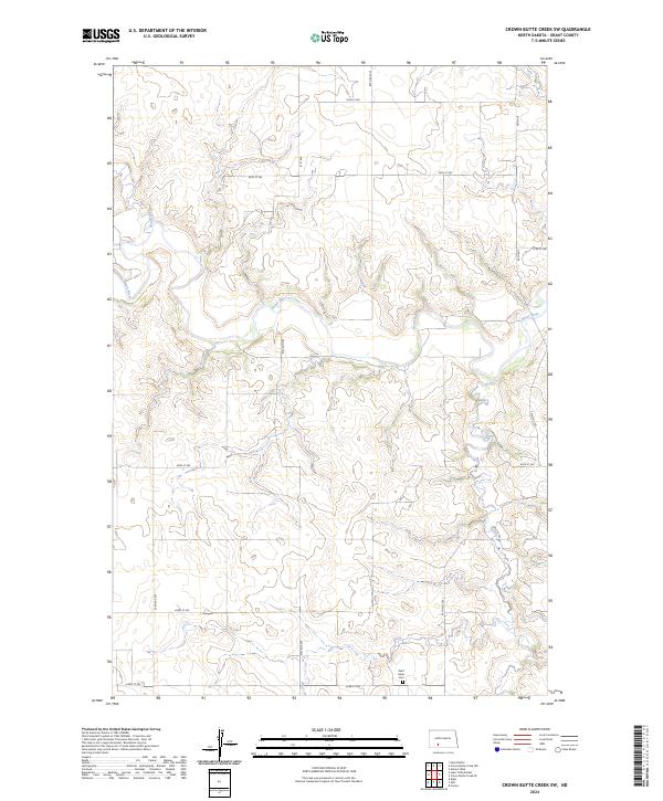
2024 Map of Crown Butte Creek SW
USGS Topo · Published 2024About this map
Heart River winds through the northern sections of this Grant County landscape, carving a deep valley through the high prairie. The terrain is characterized by intricate drainage networks, with Heart Butte Creek joining the main river channel amidst a complex of ridges and draws. This rural area is primarily defined by the Public Land Survey System grid, visible in the section boundaries of t136n r88w and t135n r88w. Near the southern edge of the survey, the Saint Johns Cem serves as a significant local landmark for genealogists and family historians, situated along the section lines near 63rd St SW. The map documents a sparsely populated ranching or farming region where the natural topography of the river breaks dictates the placement of local roads like 60th Ave SW and 61st Ave.
Find a feature on this map
21 named features on this map. Tap any name to fly to it.
Don’t see what you’re looking for? This feature index may not catch every label — zoom into the map to look around manually.
Map Details
Editions of this 2024 Crown Butte Creek SW Map
This is the sole edition of this map. No revisions or reprints were ever made.
Other maps of this area

1938 · Heart Butte
USGS Topo · 1:48,000

1944 · Heart Butte
USGS Topo · 1:62,500

1954 · Bismarck
USGS Topo · 1:250,000

1958 · Bismarck
USGS Topo · 1:250,000

1960 · Heart Butte
USGS Topo · 1:24,000

1980 · Crown Butte Creek NW
USGS Topo · 1:24,000
1980 · Lake Tschida East
USGS Topo · 1:24,000

1980 · Crown Butte Creek SE
USGS Topo · 1:24,000

1980 · Heil
USGS Topo · 1:24,000

1980 · Crown Butte Creek SW
USGS Topo · 1:24,000