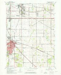
1962 Map of Crown Point
USGS Topo · Published 1964About this map
Crown Point serves as the focal point of this Northwest Indiana landscape during a period of significant suburban expansion and infrastructure development. The map illustrates the transition from rural township sections to residential developments like Chapel Manor, Southmoor Park, and Independence Hill. Vital transportation corridors anchor the area, including the Pennsylvania and Erie-Lackawanna railroads, alongside the Old Lincoln Way.
Find a feature on this map
60 named features on this map. Tap any name to fly to it.
Don’t see what you’re looking for? This feature index may not catch every label — zoom into the map to look around manually.
Map Details
Editions of this 1962 Crown Point Map
4 editions found
Other maps of this area

1900 · Toleston
USGS Topo · 1:62,500

1934 · Porter
USGS Topo · 1:48,000

1940 · Porter
USGS Topo · 1:62,500

1953 · Leroy
USGS Topo · 1:24,000

1953 · St. John
USGS Topo · 1:24,000

1953 · Palmer
USGS Topo · 1:24,000

1953 · Gary
USGS Topo · 1:24,000

1953 · Crown Point
USGS Topo · 1:24,000

1953 · Hebron
USGS Topo · 1:24,000

1953 · Garyton
USGS Topo · 1:24,000