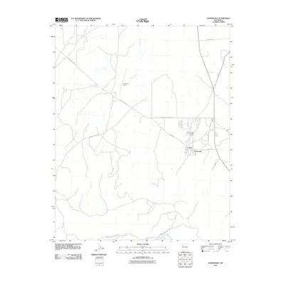
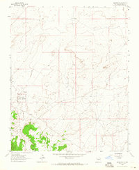
2010 Map of Crownpoint
USGS Topo · Published 2010About this map
Crownpoint serves as the primary hub of this high-desert region, organized around a network of tribal and federal infrastructure. The settlement is anchored by the Crownpoint Post Office and the Crownpoint Airport, reflecting its role as a regional center for the Eastern Navajo Agency. The town's grid is defined by streets such as Chaco Blvd and Stacher St, while the broader landscape is carved by the ephemeral drainage of Indian Creek and the southern Puerco River. Significant transportation corridors, including Navajo Service Route 9 and Navajo Service Route 11, converge here, illustrating the transition from rural desert expanses to a structured community. The presence of multiple Indian Service Routes, such as Indian Service Route 7052, highlights the specialized administrative and logistical framework of the area during the early 21st century.
Find a feature on this map
15 named features on this map. Tap any name to fly to it.
Don’t see what you’re looking for? This feature index may not catch every label — zoom into the map to look around manually.
Map Details
Editions of this 2010 Crownpoint Map
This is the sole edition of this map. No revisions or reprints were ever made.
Other maps of this area

1886 · Wingate
USGS Topo · 1:250,000

1892 · Wingate
USGS Topo · 1:250,000

1954 · Gallup
USGS Topo · 1:250,000

1958 · Gallup
USGS Topo · 1:250,000

1959 · Gallup
USGS Topo · 1:250,000

1962 · Gallup
USGS Topo · 1:250,000
1963 · Hosta Butte
USGS Topo · 1:24,000
1963 · Crownpoint
USGS Topo · 1:24,000
1963 · Casamero Lake
USGS Topo · 1:24,000
1963 · Heart Rock
USGS Topo · 1:24,000
Featured Places
- Crownpoint, Eastern Navajo Agency
- Eastern Navajo Agency, NM
- McKinley County, NM
- United States
- New Mexico