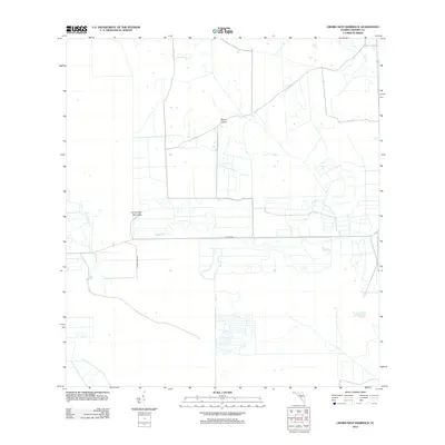
2012 Map of Crows Nest Hammock
USGS Topo · Published 2012About this map
Crows Nest Hammock and Dinner Island define the interior of this Hendry County landscape, characterized by the distinct vegetation patterns and elevated ground typical of South Florida’s inland hammocks. The map shows a transition from structured agricultural or water management plots to more open terrain, intersected by essential transport routes like Co Hwy 846 and the aptly named Crow's Nest Rd. In the southeastern corner, Rocky Lake sits as a solitary water body within a grid of drainage features. The geometric layout of the surrounding land suggests a high degree of modification for drainage and farming, common for this era in the Everglades region. Researchers can observe the balance between remaining natural features and the expanding footprint of land development.
Find a feature on this map
5 named features on this map. Tap any name to fly to it.
Don’t see what you’re looking for? This feature index may not catch every label — zoom into the map to look around manually.
Map Details
Editions of this 2012 Crows Nest Hammock Map
This is the sole edition of this map. No revisions or reprints were ever made.
Other maps of this area

1956 · West Palm Beach
USGS Topo · 1:250,000

1957 · West Palm Beach
USGS Topo · 1:250,000

1958 · West Palm Beach
USGS Topo · 1:250,000

1958 · Felda SE
USGS Topo · 1:24,000

1958 · Sunniland
USGS Topo · 1:24,000

1958 · Immokalee NE
USGS Topo · 1:24,000

1970 · La Belle 4 SE
USGS Topo · 1:24,000

1971 · La Belle 4 SW
USGS Topo · 1:24,000

1974 · Immokalee 1 SW
USGS Topo · 1:24,000

1974 · Immokalee 1 SE
USGS Topo · 1:24,000