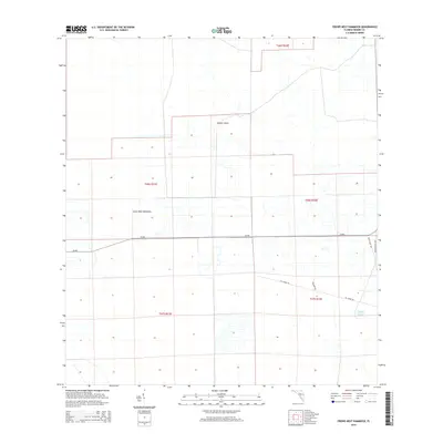
2015 Map of Crows Nest Hammock
USGS Topo · Published 2015About this map
Crows Nest Hammock and Dinner Island stand out as distinct upland features within this section of the Florida Everglades drainage basin. The landscape is defined by a grid of large agricultural and conservation parcels, organized by township and range lines including t46s r31e and t47s r32e. Water management and transportation are central to the area's layout, with Cr-846 providing the primary east-west corridor across the flat, canal-laced terrain. To the southeast, Rocky Lake is accessible via a network of rural routes such as Obannon Rd and FPL Grade Rd, reflecting the managed nature of this interior landscape. The map illustrates the transition from natural hammock formations to the industrial-scale agricultural operations and ranching tracts typical of Hendry County's rural interior.
Find a feature on this map
12 named features on this map. Tap any name to fly to it.
Don’t see what you’re looking for? This feature index may not catch every label — zoom into the map to look around manually.
Map Details
Editions of this 2015 Crows Nest Hammock Map
This is the sole edition of this map. No revisions or reprints were ever made.
Other maps of this area

1956 · West Palm Beach
USGS Topo · 1:250,000

1957 · West Palm Beach
USGS Topo · 1:250,000

1958 · West Palm Beach
USGS Topo · 1:250,000

1958 · Felda SE
USGS Topo · 1:24,000

1958 · Sunniland
USGS Topo · 1:24,000

1958 · Immokalee NE
USGS Topo · 1:24,000

1970 · La Belle 4 SE
USGS Topo · 1:24,000

1971 · La Belle 4 SW
USGS Topo · 1:24,000

1974 · Immokalee 1 SW
USGS Topo · 1:24,000

1974 · Immokalee 1 SE
USGS Topo · 1:24,000