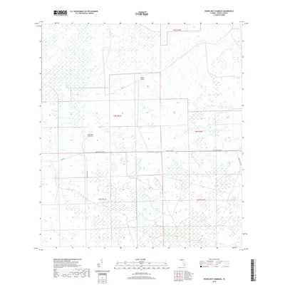
2018 Map of Crows Nest Hammock
USGS Topo · Published 2018About this map
Dinner Island and the elevated landscape of Crows Nest Hammock define this interior portion of the Florida Everglades region. The map illustrates a complex network of seasonal drainage and wetlands, including the elongated Crows Nest Slough and the winding Boggy Slough, which are interspersed with isolated patches of higher ground like Tony Strand. Significant infrastructure is visible along the Hendry Co Rd 846 corridor, where the Immokalee Exchange and Clewiston Exchange mark critical points of transit through the swampy terrain. To the east, the natural depression of Rocky Lake and the route of Roberts Ranch Rd provide landmarks in a landscape otherwise dominated by the systematic grid of the Public Land Survey System.
Find a feature on this map
16 named features on this map. Tap any name to fly to it.
Don’t see what you’re looking for? This feature index may not catch every label — zoom into the map to look around manually.
Map Details
Editions of this 2018 Crows Nest Hammock Map
This is the sole edition of this map. No revisions or reprints were ever made.
Other maps of this area

1956 · West Palm Beach
USGS Topo · 1:250,000

1957 · West Palm Beach
USGS Topo · 1:250,000

1958 · West Palm Beach
USGS Topo · 1:250,000

1958 · Felda SE
USGS Topo · 1:24,000

1958 · Sunniland
USGS Topo · 1:24,000

1958 · Immokalee NE
USGS Topo · 1:24,000

1970 · La Belle 4 SE
USGS Topo · 1:24,000

1971 · La Belle 4 SW
USGS Topo · 1:24,000

1974 · Immokalee 1 SW
USGS Topo · 1:24,000

1974 · Immokalee 1 SE
USGS Topo · 1:24,000