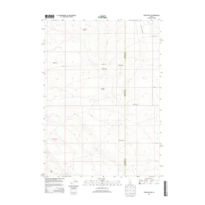
2013 Map of Crows Nest NE
USGS Topo · Published 2013About this map
Indian Ridge rises as a central topographic anchor in this high desert landscape on the border of Twin Falls and Owyhee Counties. The terrain is defined by the expanse of the Bruneau Desert and a series of rugged drainage features, most notably the seasonal course of Deadman Cr and the etched paths of Tuana Gulch and Rosevear Gulch. These natural corridors dictate the layout of the few established routes, such as Crows Nest Rd and the Glenns Ferry Castleford Rd, which navigate the elevation changes between the desert floor and Blue Ridge. The lack of significant residential development highlights a landscape largely shaped by its hydrology and traditional ranching or transit corridors in this remote section of southern Idaho.
Find a feature on this map
15 named features on this map. Tap any name to fly to it.
Don’t see what you’re looking for? This feature index may not catch every label — zoom into the map to look around manually.
Map Details
Editions of this 2013 Crows Nest NE Map
This is the sole edition of this map. No revisions or reprints were ever made.
Other maps of this area

1948 · Twentymile Butte
USGS Topo · 1:24,000

1949 · Pasadena Valley
USGS Topo · 1:62,500

1949 · Hagerman
USGS Topo · 1:24,000

1949 · Indian Butte
USGS Topo · 1:24,000

1950 · Hagerman
USGS Topo · 1:24,000
1950 · Indian Butte
USGS Topo · 1:24,000

1955 · Twin Falls
USGS Topo · 1:250,000

1958 · Twin Falls
USGS Topo · 1:250,000

1959 · Buhl
USGS Topo · 1:62,500

1959 · Crows Nest
USGS Topo · 1:62,500