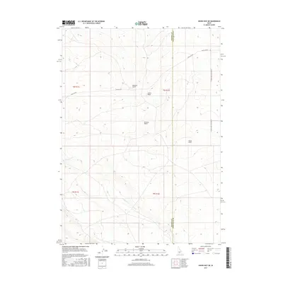
2017 Map of Crows Nest NE
USGS Topo · Published 2017About this map
Bruneau Desert defines the arid character of this high-plateau landscape, where the boundary between Owyhee and Twin Falls counties bisects the terrain. The map details a network of drainage features and seasonal watercourses, most notably the winding path of Deadman Cr. Significant geological landforms such as Indian Ridge and the deep cuts of Rosevear Gulch and Tuana Gulch illustrate the erosive forces at work in this part of Idaho. Transportation in this section of the Snake River Plain is represented by established routes including Crows Nest Rd and the Glenns Ferry Castleford Rd, which provide passage through the sparse, open country that has historically supported ranching and transit across the southern desert.
Find a feature on this map
13 named features on this map. Tap any name to fly to it.
Don’t see what you’re looking for? This feature index may not catch every label — zoom into the map to look around manually.
Map Details
Editions of this 2017 Crows Nest NE Map
This is the sole edition of this map. No revisions or reprints were ever made.
Other maps of this area

1948 · Twentymile Butte
USGS Topo · 1:24,000

1949 · Pasadena Valley
USGS Topo · 1:62,500

1949 · Hagerman
USGS Topo · 1:24,000

1949 · Indian Butte
USGS Topo · 1:24,000

1950 · Hagerman
USGS Topo · 1:24,000
1950 · Indian Butte
USGS Topo · 1:24,000

1955 · Twin Falls
USGS Topo · 1:250,000

1958 · Twin Falls
USGS Topo · 1:250,000

1959 · Buhl
USGS Topo · 1:62,500

1959 · Crows Nest
USGS Topo · 1:62,500