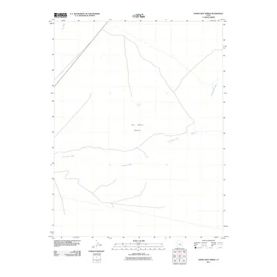
2011 Map of Crows Nest Spring
USGS Topo · Published 2011About this map
The San Rafael Desert dominates this arid landscape, characterized by vast expanses of open terrain cut by intermittent watercourses. In this high desert environment, life-sustaining water sources are the primary landmarks, notably Crows Nest Spring near the center of the sheet and Cottonwood Spring further east. These points have long served as vital stops for those navigating the region's sparse infrastructure. Drainage patterns define the topography, with the winding paths of Cottonwood Wash and Iron Wash illustrating the erosional forces that shape this part of Emery County. The map provides a detailed look at the fundamental desert geography and the few critical water points that dictate movement through this remote territory.
Find a feature on this map
5 named features on this map. Tap any name to fly to it.
Don’t see what you’re looking for? This feature index may not catch every label — zoom into the map to look around manually.
Map Details
Editions of this 2011 Crows Nest Spring Map
This is the sole edition of this map. No revisions or reprints were ever made.
Other maps of this area

1885 · San Rafael
USGS Topo · 1:250,000

1953 · Tidwell 2 SW
USGS Topo · 1:24,000

1953 · Tidwell 3 NW
USGS Topo · 1:24,000

1953 · Temple Mtn
USGS Topo · 1:62,500

1954 · Stinking Spring Creek 1 SE
USGS Topo · 1:24,000

1954 · Stinking Spring Creek 4 NE
USGS Topo · 1:24,000

1954 · Stinking Spring Creek 4 SE
USGS Topo · 1:24,000

1954 · Tidwell 2 SE
USGS Topo · 1:24,000

1954 · Tidwell Bottoms
USGS Topo · 1:62,500
1954 · The Wickiup
USGS Topo · 1:62,500