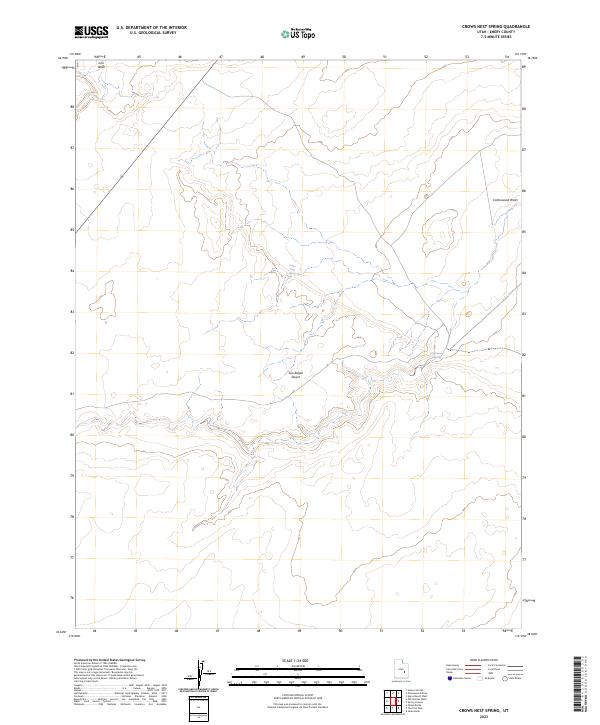
2023 Map of Crows Nest Spring
USGS Topo · Published 2023About this map
The San Rafael Desert dominates this corner of Emery County, Utah, where water sources dictate the movement of travelers and wildlife across the arid landscape. While much of the terrain is defined by dry washes and high-desert contours, specific points like Crows Nest Spring and Cottonwood Spring provide critical relief. The hydrology is further shaped by Iron Wash in the northwest and Cottonwood Wash in the northeast, both of which serve as the primary drainage paths through the desert floor. This 2023 survey indicates a terrain largely void of permanent settlements, reflecting the enduringly wild nature of the region where seasonal drainages and isolated springs remain the most prominent landmarks for those navigating the eastern edge of the San Rafael Swell.
Find a feature on this map
5 named features on this map. Tap any name to fly to it.
Don’t see what you’re looking for? This feature index may not catch every label — zoom into the map to look around manually.
Map Details
Editions of this 2023 Crows Nest Spring Map
This is the sole edition of this map. No revisions or reprints were ever made.
Other maps of this area

1885 · San Rafael
USGS Topo · 1:250,000

1953 · Tidwell 2 SW
USGS Topo · 1:24,000

1953 · Tidwell 3 NW
USGS Topo · 1:24,000

1953 · Temple Mtn
USGS Topo · 1:62,500

1954 · Stinking Spring Creek 1 SE
USGS Topo · 1:24,000

1954 · Stinking Spring Creek 4 NE
USGS Topo · 1:24,000

1954 · Stinking Spring Creek 4 SE
USGS Topo · 1:24,000

1954 · Tidwell 2 SE
USGS Topo · 1:24,000

1954 · Tidwell Bottoms
USGS Topo · 1:62,500
1954 · The Wickiup
USGS Topo · 1:62,500