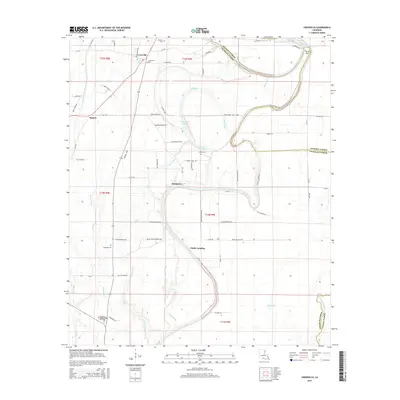
2015 Map of Crowville
USGS Topo · Published 2015About this map
Crowville and the winding course of Bayou Macon anchor this survey of the Franklin Parish interior. The landscape is defined by its complex hydrography, where the main bayou is flanked by older water features like French Turn and Macon Cutoff Number 2. Small, dispersed settlements such as Swampers, Chelly Landing, and Bushes are connected by a network of rural roads that often follow the natural contours of the bayous and brakes.
Find a feature on this map
76 named features on this map. Tap any name to fly to it.
Don’t see what you’re looking for? This feature index may not catch every label — zoom into the map to look around manually.
Map Details
Editions of this 2015 Crowville Map
This is the sole edition of this map. No revisions or reprints were ever made.
Other maps of this area

1935 · Winnsboro
USGS Topo · 1:62,500

1935 · Baskinton
USGS Topo · 1:62,500

1935 · Waverly
USGS Topo · 1:62,500

1935 · Shackleford Lake
USGS Topo · 1:62,500

1955 · Jackson
USGS Topo · 1:250,000

1958 · Baskinton
USGS Topo · 1:62,500

1958 · Shackleford Lake
USGS Topo · 1:62,500

1958 · Winnsboro
USGS Topo · 1:62,500

1961 · Jackson
USGS Topo · 1:250,000

1961 · Waverly
USGS Topo · 1:62,500