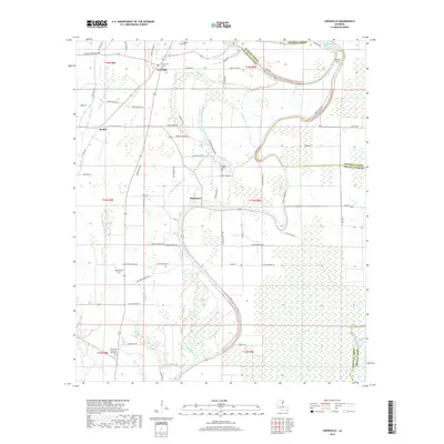
2018 Map of Crowville
USGS Topo · Published 2018About this map
Crowville serves as a primary hub in this portion of Franklin Parish, where the local landscape is defined by the winding course of Bayou Macon and a complex network of wetlands and brakes. The map documents a rural society deeply rooted in its geography, with small settlements like Swampers and Bushes connected by parish roads that trace the higher ground between the bayous. Significant local-history detail is preserved through the naming of several graveyards, including the Crowville Cem, Masonic Cem, and Magnolia Cem. The interplay between the land and water is evident in features such as the French Turn and numerous brakes like Boggy Womble Brake and Royal Brake. Many road names, such as Roddie Emfinger Rd and Preacher Simons Rd, reflect the families who have shaped this agricultural and riverine region.
Find a feature on this map
77 named features on this map. Tap any name to fly to it.
Don’t see what you’re looking for? This feature index may not catch every label — zoom into the map to look around manually.
Map Details
Editions of this 2018 Crowville Map
This is the sole edition of this map. No revisions or reprints were ever made.
Other maps of this area

1935 · Winnsboro
USGS Topo · 1:62,500

1935 · Baskinton
USGS Topo · 1:62,500

1935 · Waverly
USGS Topo · 1:62,500

1935 · Shackleford Lake
USGS Topo · 1:62,500

1955 · Jackson
USGS Topo · 1:250,000

1958 · Baskinton
USGS Topo · 1:62,500

1958 · Shackleford Lake
USGS Topo · 1:62,500

1958 · Winnsboro
USGS Topo · 1:62,500

1961 · Jackson
USGS Topo · 1:250,000

1961 · Waverly
USGS Topo · 1:62,500