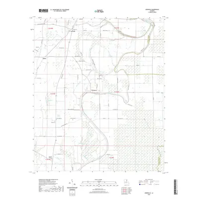
2020 Map of Crowville
USGS Topo · Published 2020About this map
Crowville and the surrounding lowland landscape of Franklin Parish are defined by the winding course of Bayou Macon and its complex network of tributaries. The terrain is a mosaic of brakes and bayous, including the descriptively named Boggy Womble Brake and Howell Brake, which illustrate the hydrological character of this portion of Louisiana. The settlement pattern follows the higher ground between these waterways, with the small communities of Swampers and Bushes connected by a grid of rural roads often named for local families, such as Glynn Bradley Rd and Preston Shivers Rd.
Find a feature on this map
75 named features on this map. Tap any name to fly to it.
Don’t see what you’re looking for? This feature index may not catch every label — zoom into the map to look around manually.
Map Details
Editions of this 2020 Crowville Map
This is the sole edition of this map. No revisions or reprints were ever made.
Other maps of this area

1935 · Winnsboro
USGS Topo · 1:62,500

1935 · Baskinton
USGS Topo · 1:62,500

1935 · Waverly
USGS Topo · 1:62,500

1935 · Shackleford Lake
USGS Topo · 1:62,500

1955 · Jackson
USGS Topo · 1:250,000

1958 · Baskinton
USGS Topo · 1:62,500

1958 · Shackleford Lake
USGS Topo · 1:62,500

1958 · Winnsboro
USGS Topo · 1:62,500

1961 · Jackson
USGS Topo · 1:250,000

1961 · Waverly
USGS Topo · 1:62,500