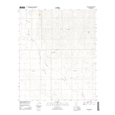
2014 Map of Crozier Peak
USGS Topo · Published 2014About this map
Crozier Peak and the surrounding Tortilla Mountains define this high-desert region of Pinal County, where an intricate network of drainage systems like Donnelly Wash and Indian Camp Wash carve through the arid terrain. The landscape is marked by the long-distance route of the Arizona National Scenic Trail, which winds its way from the northern heights near Ripsey Hill down through the central ridges. Human presence is largely defined by ranching infrastructure and remote access routes, including Haydon Ranch Rd and Tecolote Ranch Rd. The survey reveals the complex topography of the Gila River valley watershed, where numerous ephemeral streams such as Eagle Wash and Swingle Wash flow through the foothills of the mineral-rich mountains of central Arizona.
Find a feature on this map
24 named features on this map. Tap any name to fly to it.
Don’t see what you’re looking for? This feature index may not catch every label — zoom into the map to look around manually.
Map Details
Editions of this 2014 Crozier Peak Map
This is the sole edition of this map. No revisions or reprints were ever made.
Other maps of this area

1900 · Florence
USGS Topo · 1:125,000

1902 · Florence
USGS Topo · 1:125,000

1910 · Ray
USGS Topo · 1:62,500

1911 · Winkelman
USGS Topo · 1:125,000

1913 · Winkelman
USGS Topo · 1:125,000

1934 · Newman Peak
USGS Topo · 1:125,000

1949 · Crozier Peak
USGS Topo · 1:24,000

1949 · Winkelman
USGS Topo · 1:24,000

1949 · Winkelman
USGS Topo · 1:62,500

1949 · Black Mountain
USGS Topo · 1:24,000