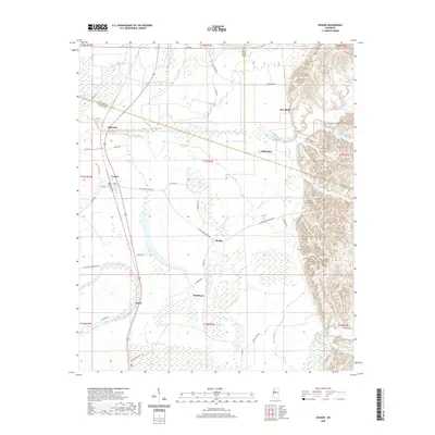
2020 Map of Cruger
USGS Topo · Published 2020About this map
Cruger sits at the intersection of the Mississippi Delta's agricultural landscape and the rising bluff line to the east. This survey reveals a region defined by its complex hydrology, where the winding Abiaca Creek and Millstone Bayou traverse the lowlands toward Tchula Lake and Morgan Brake. The settlement pattern follows the drainage and the rail corridor, connecting smaller communities like Dulweber, Keirn, and Meeks.
Find a feature on this map
60 named features on this map. Tap any name to fly to it.
Don’t see what you’re looking for? This feature index may not catch every label — zoom into the map to look around manually.
Map Details
Editions of this 2020 Cruger Map
This is the sole edition of this map. No revisions or reprints were ever made.
Other maps of this area

1940 · Seven Pines
USGS Topo · 1:62,500

1940 · Lexington
USGS Topo · 1:62,500

1940 · Mileston
USGS Topo · 1:62,500

1953 · Greenwood
USGS Topo · 1:250,000

1954 · Mileston
USGS Topo · 1:62,500

1956 · Greenwood
USGS Topo · 1:250,000

1957 · Lexington
USGS Topo · 1:62,500

1957 · Seven Pines
USGS Topo · 1:62,500

1958 · Seven Pines
USGS Topo · 1:62,500

1958 · Lexington
USGS Topo · 1:62,500