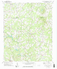
1974 Map of Crutchfield Crossroads
USGS Topo · Published 1976About this map
Rocky River winds through the heart of the North Carolina piedmont, defining a landscape of agricultural tradition and community nodes during the mid-1970s. The settlement at Crutchfield Crossroads serves as a central point for the surrounding rural area, which is heavily marked by its spiritual and social centers. Numerous country churches, including Rocky River Ch, Pleasant Hill Ch, and Piney Grove Ch, are dispersed across the terrain, often accompanied by local cemeteries that serve as vital records for genealogists.
Find a feature on this map
29 named features on this map. Tap any name to fly to it.
Don’t see what you’re looking for? This feature index may not catch every label — zoom into the map to look around manually.
Map Details
Editions of this 1974 Crutchfield Crossroads Map
2 editions found
Other maps of this area

1953 · Raleigh
USGS Topo · 1:250,000

1954 · Raleigh
USGS Topo · 1:250,000

1968 · Coleridge
USGS Topo · 1:24,000

1969 · Siler City
USGS Topo · 1:24,000

1970 · Kimesville
USGS Topo · 1:24,000

1970 · Siler City NE
USGS Topo · 1:24,000

1974 · Silk Hope
USGS Topo · 1:24,000

1974 · Crutchfield Crossroads
USGS Topo · 1:24,000
1974 · Liberty
USGS Topo · 1:24,000
1977 · Saxapahaw
USGS Topo · 1:24,000