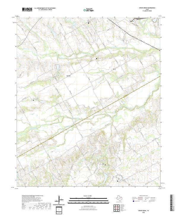
2022 Map of Cryer Creek
USGS Topo · Published 2022About this map
The boundary between ELLIS CO and NAVARRO CO cuts diagonally across this central Texas landscape, where the settlements of Byrd and Rankin anchor a region defined by its winding waterways and rural cemeteries. The hydrography is dominated by the sprawling reaches of Chambers Creek and its many tributaries, including Mill Cr and Big Onion Cr. These creek valleys create a complex topography of drainage patterns that have historically shaped the placement of farm-to-market roads and early homesteads.
Find a feature on this map
68 named features on this map. Tap any name to fly to it.
Don’t see what you’re looking for? This feature index may not catch every label — zoom into the map to look around manually.
Map Details
Editions of this 2022 Cryer Creek Map
This is the sole edition of this map. No revisions or reprints were ever made.
Other maps of this area

1954 · Dallas
USGS Topo · 1:250,000

1956 · Ennis
USGS Topo · 1:62,500

1958 · Dallas
USGS Topo · 1:250,000

1961 · Forreston
USGS Topo · 1:24,000

1962 · Emhouse
USGS Topo · 1:24,000

1962 · Ennis West
USGS Topo · 1:24,000

1962 · Ennis East
USGS Topo · 1:24,000

1962 · Cryer Creek
USGS Topo · 1:24,000
1965 · Avalon
USGS Topo · 1:24,000
1965 · Blooming Grove
USGS Topo · 1:24,000