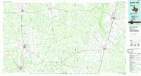
1985 Map of Crystal City
USGS Topo · Published 1985About this map
Big Wells Oil Field and the agricultural corridors of the Texas Brush Country anchor this 1980s-era study. The landscape is defined by the systems of the Nueces River and Frio River, where water availability dictated the growth of regional hubs like Crystal City and Carrizo Springs. A complex network of irrigation and infrastructure is evident, particularly around Winter Haven and Batesville, reflecting the intensive land use of the Winter Garden Region.
Find a feature on this map
69 named features on this map. Tap any name to fly to it.
Don’t see what you’re looking for? This feature index may not catch every label — zoom into the map to look around manually.
Map Details
Editions of this 1985 Crystal City Map
2 editions found
Other maps of this area

1896 · Brackett
USGS Topo · 1:125,000

1897 · Brackett
USGS Topo · 1:125,000

1898 · Uvalde
USGS Topo · 1:125,000

1899 · Uvalde
USGS Topo · 1:125,000

1925 · San Roque Lake 1-a
USGS Topo · 1:48,000

1925 · Pearsall 1-b
USGS Topo · 1:48,000

1925 · Pearsall 1-c
USGS Topo · 1:48,000

1927 · Pearsall
USGS Topo · 1:62,500

1927 · Bart
USGS Topo · 1:62,500

1928 · Frio Town
USGS Topo · 1:62,500