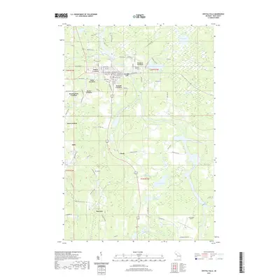
2019 Map of Crystal Falls
USGS Topo · Published 2019About this map
The Paint River winds through this Upper Peninsula landscape, anchoring the settlement of Crystal Falls. The town's layout is defined by the Iron County Courthouse and a series of historic mining "locations" that reflect the area's industrial heritage, including Odgers Location, Tobin Location, and Kimball Location. These distinct residential clusters developed around specific mine sites, creating a unique dispersed settlement pattern. To the south, the communities of Alpha and Mastodon sit near the broad Panola Plains, where the terrain transitions into a dense network of water bodies like Finn Lake and Kennedy Lake. Significant local landmarks such as Evergreen Memorial Cem and the Iron County Airport provide modern context to this landscape of mixed forest and wetlands.
Find a feature on this map
98 named features on this map. Tap any name to fly to it.
Don’t see what you’re looking for? This feature index may not catch every label — zoom into the map to look around manually.
Map Details
Editions of this 2019 Crystal Falls Map
This is the sole edition of this map. No revisions or reprints were ever made.
Other maps of this area

1899 · Sagola
USGS Topo · 1:62,500

1899 · Crystal Falls
USGS Topo · 1:62,500

1939 · Iron Mountain
USGS Topo · 1:48,000

1941 · Florence
USGS Topo · 1:48,000

1941 · Iron Mountain
USGS Topo · 1:48,000

1944 · Crystal Falls
USGS Topo · 1:24,000

1944 · Fortune Lakes
USGS Topo · 1:24,000

1945 · Kelso Junction
USGS Topo · 1:24,000

1945 · Amasa
USGS Topo · 1:24,000

1946 · Crystal Falls
USGS Topo · 1:31,680