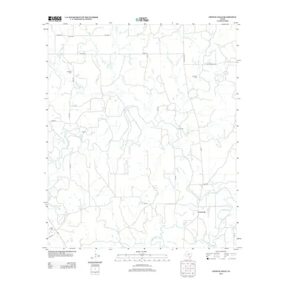
2012 Map of Crystal Falls
USGS Topo · Published 2012About this map
Crystal Falls is situated at a point of transition where numerous drainage systems converge, including the Clear Fork of the Brazos River and Hubbard Cr. The landscape is defined by its dendritic water network, with names like Six Shooter Cr, Peacock Cr, and Huffstuttle Cr reflecting the early cattle-ranching and settlement history of Stephens County. Genealogists can identify several distinct family-associated burial grounds, such as Smith Cem, Mathiews Cem, and the uniquely named Snake Den Cem in the southwestern quadrant. These small, scattered cemeteries, along with Hurford Cem and Stoker Cem, provide evidence of a dispersed rural population that built its life around the creek beds and reservoirs like the Lester Clark Reservoir. The road network is primarily composed of county roads and farm-to-market routes like FM 1481, which link these isolated homesteads and historical landmarks.
Find a feature on this map
40 named features on this map. Tap any name to fly to it.
Don’t see what you’re looking for? This feature index may not catch every label — zoom into the map to look around manually.
Map Details
Editions of this 2012 Crystal Falls Map
This is the sole edition of this map. No revisions or reprints were ever made.
Other maps of this area

1890 · Breckenridge
USGS Topo · 1:125,000

1892 · Albany
USGS Topo · 1:125,000

1893 · Albany
USGS Topo · 1:125,000

1954 · Abilene
USGS Topo · 1:250,000

1954 · Wichita Falls
USGS Topo · 1:250,000

1958 · Wichita Falls
USGS Topo · 1:250,000

1958 · Abilene
USGS Topo · 1:250,000

1958 · Breckenridge
USGS Topo · 1:24,000

1958 · Edwards Branch
USGS Topo · 1:24,000

1965 · Lusk
USGS Topo · 1:24,000