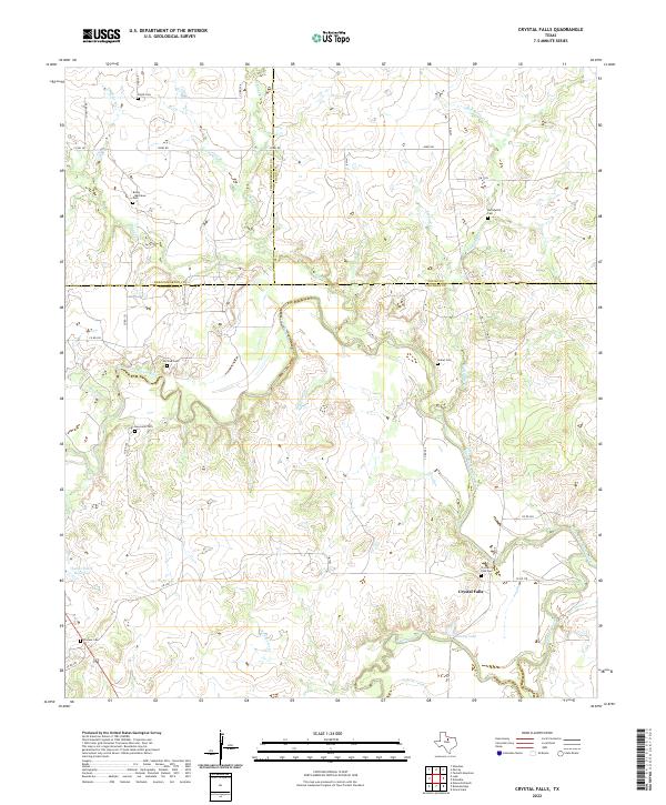
2022 Map of Crystal Falls
USGS Topo · Published 2022About this map
The Clear Fork Brazos River winds through this rugged section of the Texas interior, where the boundaries of Stephens, Throckmorton, and Young Counties converge. This 2022 survey documents a landscape defined by the confluence of major waterways and a long history of family-named landmarks. The settlement of Crystal Falls sits near the southern bend of the river, marked by the Crystal Falls Cem and the nearby Dooley Lake. Further downstream, the river is joined by numerous tributaries including Huffstuttle Cr, Peacock Cr, and Givens Cr.
Find a feature on this map
44 named features on this map. Tap any name to fly to it.
Don’t see what you’re looking for? This feature index may not catch every label — zoom into the map to look around manually.
Map Details
Editions of this 2022 Crystal Falls Map
This is the sole edition of this map. No revisions or reprints were ever made.
Other maps of this area

1890 · Breckenridge
USGS Topo · 1:125,000

1892 · Albany
USGS Topo · 1:125,000

1893 · Albany
USGS Topo · 1:125,000

1954 · Abilene
USGS Topo · 1:250,000

1954 · Wichita Falls
USGS Topo · 1:250,000

1958 · Wichita Falls
USGS Topo · 1:250,000

1958 · Abilene
USGS Topo · 1:250,000

1958 · Breckenridge
USGS Topo · 1:24,000

1958 · Edwards Branch
USGS Topo · 1:24,000

1965 · Lusk
USGS Topo · 1:24,000