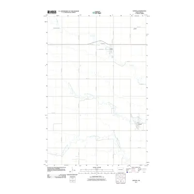
2011 Map of Crystal
USGS Topo · Published 2011About this map
Crystal and Hoople anchor this section of Walsh County, showcasing the organized grid of the Red River Valley’s agricultural landscape. The region is defined by the winding paths of the North Branch Park River and the Middle Branch Park River, which provide natural relief to the surrounding section lines and farmsteads. Near the northern boundary, Cart Creek meanders toward the Crystal Dam, a focal point just west of the town center. Local history and genealogy are well-represented by landmarks such as the West Point Cemetery in the northwest and the Augustin Seed Farm further east, reflecting the area's deep ties to its farming heritage. The map details a dense network of township roads, including County Rd 12 and numerous numbered streets that have facilitated the transport of grain and seed for generations.
Find a feature on this map
27 named features on this map. Tap any name to fly to it.
Don’t see what you’re looking for? This feature index may not catch every label — zoom into the map to look around manually.
Map Details
Editions of this 2011 Crystal Map
This is the sole edition of this map. No revisions or reprints were ever made.
Other maps of this area

1944 · Crystal
USGS Topo · 1:62,500

1952 · Thief River Falls
USGS Topo · 1:250,000

1956 · Thief River Falls
USGS Topo · 1:250,000

1957 · Thief River Falls
USGS Topo · 1:250,000

1963 · Crystal SE
USGS Topo · 1:24,000

1963 · Crystal
USGS Topo · 1:24,000

1963 · Edinburg
USGS Topo · 1:24,000

1963 · Gardar
USGS Topo · 1:24,000

1963 · Nash
USGS Topo · 1:24,000

1963 · Park River
USGS Topo · 1:24,000