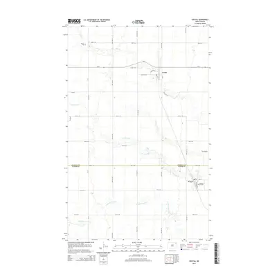
2014 Map of Crystal
USGS Topo · Published 2014About this map
Crystal and Hoople anchor this section of the Red River Valley, where the grid of section roads meets a network of winding waterways. The landscape is defined by the eastern flow of Cart Cr, the N Br Park River, and the Middle Br Park River, which cut intricate paths through the agricultural plains. Significant local markers include the W Point Cem in the northwest and the Anderson Strip Airport near Hoople, reflecting the region's long-standing reliance on rural aviation and localized community hubs. The transition between Pembina Co and Walsh Co is clearly delineated, crossing through open fields and a distinct landform known as The Coulee in the east. This survey provides a precise record of the road network, including ND-66, and the small-town street layouts of these two established settlements.
Find a feature on this map
23 named features on this map. Tap any name to fly to it.
Don’t see what you’re looking for? This feature index may not catch every label — zoom into the map to look around manually.
Map Details
Editions of this 2014 Crystal Map
This is the sole edition of this map. No revisions or reprints were ever made.
Other maps of this area

1944 · Crystal
USGS Topo · 1:62,500

1952 · Thief River Falls
USGS Topo · 1:250,000

1956 · Thief River Falls
USGS Topo · 1:250,000

1957 · Thief River Falls
USGS Topo · 1:250,000

1963 · Crystal SE
USGS Topo · 1:24,000

1963 · Crystal
USGS Topo · 1:24,000

1963 · Edinburg
USGS Topo · 1:24,000

1963 · Gardar
USGS Topo · 1:24,000

1963 · Nash
USGS Topo · 1:24,000

1963 · Park River
USGS Topo · 1:24,000