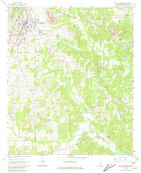
1963 Map of Crystal Springs
USGS Topo · Published 1981About this map
Crystal Springs serves as the primary hub of activity in this 1963 survey, centered on the Illinois Central railroad corridor. The town's infrastructure is well-defined, featuring an Athletic Field, Sewage Disposal facilities, and the Crystal Springs Lookout Tower. Beyond the municipal center, the landscape of Copiah County is defined by an extensive network of small gravel operations, indicated by numerous Gravel Pit and Gravel Pits labels scattered across the terrain.
Find a feature on this map
33 named features on this map. Tap any name to fly to it.
Don’t see what you’re looking for? This feature index may not catch every label — zoom into the map to look around manually.
Map Details
Editions of this 1963 Crystal Springs Map
2 editions found
Other maps of this area

1903 · Jackson
USGS Topo · 1:125,000

1906 · Florence
USGS Topo · 1:62,500

1908 · Florence
USGS Topo · 1:62,500

1937 · Terry
USGS Topo · 1:48,000

1943 · Terry
USGS Topo · 1:62,500

1953 · Natchez
USGS Topo · 1:250,000

1955 · Jackson
USGS Topo · 1:250,000

1956 · Natchez
USGS Topo · 1:250,000

1959 · Natchez
USGS Topo · 1:250,000

1961 · Jackson
USGS Topo · 1:250,000