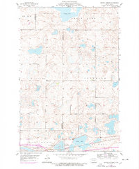
1955 Map of Crystal Springs
USGS Topo · Published 1978About this map
Crystal Springs serves as the focal point of this mid-century prairie landscape, situated along the Burlington Northern railroad corridor. The area is defined by a glacial pothole terrain featuring numerous water bodies, most notably the expansive Chase Lake in the north and Stink Lake to the south. Near the namesake settlement, the Crystal Springs Youth Camp and local infrastructure like the Town Hall reflect the community's social organization.
Find a feature on this map
16 named features on this map. Tap any name to fly to it.
Don’t see what you’re looking for? This feature index may not catch every label — zoom into the map to look around manually.
Map Details
Editions of this 1955 Crystal Springs Map
2 editions found
Other maps of this area

1952 · Tappen SE
USGS Topo · 1:24,000

1952 · Tappen NE
USGS Topo · 1:24,000

1952 · New Rockford
USGS Topo · 1:250,000

1953 · Jamestown
USGS Topo · 1:250,000

1954 · Medina
USGS Topo · 1:24,000

1955 · Crystal Springs
USGS Topo · 1:24,000

1955 · Medina SW
USGS Topo · 1:24,000

1955 · Medina SE
USGS Topo · 1:24,000

1956 · New Rockford
USGS Topo · 1:250,000

1956 · Jamestown
USGS Topo · 1:250,000