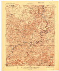
1925 Map of Cub Run
USGS Topo · Published 1925About this map
The serpentine Nolin River carves a deep path through the heart of this central Kentucky landscape, defining the borders between Grayson, Hart, and Hardin counties. In the north, the Illinois Central railroad serves the community of Clarkson and the Grayson Springs Sta, providing a vital transit link during the mid-1920s. The region is densely peppered with one-room schools such as Mulberry School and Chestnut Ridge School, reflecting the rural settlement patterns of the era.
Find a feature on this map
103 named features on this map. Tap any name to fly to it.
Don’t see what you’re looking for? This feature index may not catch every label — zoom into the map to look around manually.
Map Details
Editions of this 1925 Cub Run Map
3 editions found
Other maps of this area

1922 · Leitchfield
USGS Topo · 1:48,000

1922 · Brownsville
USGS Topo · 1:62,500

1922 · Mammoth Cave
USGS Topo · 1:62,500

1923 · Mammoth Cave
USGS Topo · 1:62,500

1923 · Brownsville
USGS Topo · 1:62,500

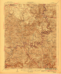
1925 · Cub Run
USGS Topo · 1:62,500

1925 · Leitchfield
USGS Topo · 1:62,500

1932 · Big Clifty
USGS Topo · 1:62,500

1934 · Munfordville
USGS Topo · 1:48,000

1935 · Horse Cave
USGS Topo · 1:48,000