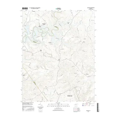
2016 Map of Cub Run
USGS Topo · Published 2016About this map
Mammoth Cave National Park borders the southern edge of this landscape where Grayson, Hart, and Edmonson counties meet. The area is defined by the winding waters of Nolin Lake and numerous creeks such as Bacon Cr, Lick Run, and Cane Run that carve through the limestone terrain. Smaller rural settlements like Cub Run, Roseburg, and Macon are connected by a network of named roads including Jericho Church Rd and Webb Ford Rd, illustrating the dispersed residential pattern of this upland region. Significant topographical features like Big Sink and Kissinger Hollow reflect the karst geology typical of the area near the national park. Local family history is centered around landmarks such as Lines Mill and the Cox Cem, while the northern reaches include the community of Pearman and the residential area of Sportsmens Paradise.
Find a feature on this map
87 named features on this map. Tap any name to fly to it.
Don’t see what you’re looking for? This feature index may not catch every label — zoom into the map to look around manually.
Map Details
Editions of this 2016 Cub Run Map
This is the sole edition of this map. No revisions or reprints were ever made.
Other maps of this area

1922 · Mammoth Cave
USGS Topo · 1:62,500

1923 · Mammoth Cave
USGS Topo · 1:62,500

1925 · Cub Run
USGS Topo · 1:62,500

1934 · Munfordville
USGS Topo · 1:48,000

1935 · Horse Cave
USGS Topo · 1:48,000

1937 · Munfordville
USGS Topo · 1:62,500

1938 · Horse Cave
USGS Topo · 1:62,500

1953 · Munfordville
USGS Topo · 1:24,000

1954 · Evansville
USGS Topo · 1:250,000

1954 · Horse Cave
USGS Topo · 1:24,000