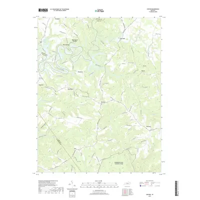
2019 Map of Cub Run
USGS Topo · Published 2019About this map
The northern reaches of Mammoth Cave National Park define the southern landscape of this 2019 survey, where the winding Cub Run flows south toward the protected parklands. This area in Kentucky sits at the intersection of Hart, Grayson, and Edmonson counties, characterized by a complex drainage system featuring the Nolin River and several sinkholes, most notably the large depression known as Big Sink. The settlement pattern consists of small, scattered communities like Winesap, Bee, and Roseburg, many linked by narrow routes such as Jericho Church Rd and Reams Church Rd. Local history is preserved in landmarks such as Cox Cem and the former mill site at Lines Mill. The map also highlights contemporary leisure developments near the river, including the aptly named Sportsmens Paradise and Pine Springs resort areas.
Find a feature on this map
92 named features on this map. Tap any name to fly to it.
Don’t see what you’re looking for? This feature index may not catch every label — zoom into the map to look around manually.
Map Details
Editions of this 2019 Cub Run Map
This is the sole edition of this map. No revisions or reprints were ever made.
Other maps of this area

1922 · Mammoth Cave
USGS Topo · 1:62,500

1923 · Mammoth Cave
USGS Topo · 1:62,500

1925 · Cub Run
USGS Topo · 1:62,500

1934 · Munfordville
USGS Topo · 1:48,000

1935 · Horse Cave
USGS Topo · 1:48,000

1937 · Munfordville
USGS Topo · 1:62,500

1938 · Horse Cave
USGS Topo · 1:62,500

1953 · Munfordville
USGS Topo · 1:24,000

1954 · Evansville
USGS Topo · 1:250,000

1954 · Horse Cave
USGS Topo · 1:24,000