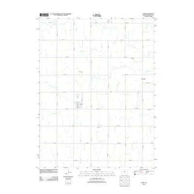
2012 Map of Cuba
USGS Topo · Published 2012About this map
Cuba serves as the central hub for this portion of Republic County, oriented along a grid of residential streets including Benton St and Bristol St. The surrounding landscape is defined by the agricultural rhythms of the Great Plains, where section roads like Co Road P and Co Road N bisect a network of prairie streams. Notable watercourses include the N Fork Mill Cr and S Fork Mill Cr, which carve subtle drainage patterns through the farmland.
Find a feature on this map
34 named features on this map. Tap any name to fly to it.
Don’t see what you’re looking for? This feature index may not catch every label — zoom into the map to look around manually.
Map Details
Editions of this 2012 Cuba Map
This is the sole edition of this map. No revisions or reprints were ever made.
Other maps of this area

1892 · Concordia
USGS Topo · 1:125,000

1893 · Washington
USGS Topo · 1:125,000

1955 · Manhattan
USGS Topo · 1:250,000

1956 · Manhattan
USGS Topo · 1:250,000

1957 · Manhattan
USGS Topo · 1:250,000

1965 · Brantford
USGS Topo · 1:24,000

1965 · Wayne
USGS Topo · 1:24,000

1965 · Agenda
USGS Topo · 1:24,000
1966 · Belleville SE
USGS Topo · 1:24,000
1966 · Narka
USGS Topo · 1:24,000