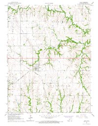
1966 Map of Cuba
USGS Topo · Published 1967About this map
The intersection of the Chicago Burlington and Quincy and the Chicago Rock Island and Pacific railroads defines the township of Cuba, serving as a central hub for this Republic County agricultural landscape in the mid-1960s. The town's religious and community life is anchored by St Isidore Ch, while the surrounding rural landscape in Farmington and Richland townships is dotted with small family and community burial grounds, including Bohemian Cem and Hawks Cem. Waterways like the North Fork Mill Creek and South Fork Mill Creek meander through the terrain, which is also crisscrossed by infrastructure including a major Pipeline. Several Sandpit operations indicate local industrial activity amidst the prevailing farmstead patterns of the era.
Find a feature on this map
19 named features on this map. Tap any name to fly to it.
Don’t see what you’re looking for? This feature index may not catch every label — zoom into the map to look around manually.
Map Details
Editions of this 1966 Cuba Map
This is the sole edition of this map. No revisions or reprints were ever made.
Other maps of this area

1892 · Concordia
USGS Topo · 1:125,000

1893 · Washington
USGS Topo · 1:125,000

1955 · Manhattan
USGS Topo · 1:250,000

1956 · Manhattan
USGS Topo · 1:250,000

1957 · Manhattan
USGS Topo · 1:250,000

1965 · Brantford
USGS Topo · 1:24,000

1965 · Wayne
USGS Topo · 1:24,000

1965 · Agenda
USGS Topo · 1:24,000
1966 · Belleville SE
USGS Topo · 1:24,000
1966 · Narka
USGS Topo · 1:24,000