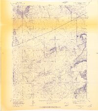
1970 Map of Cucharas Reservoir
USGS Topo · Published 1974About this map
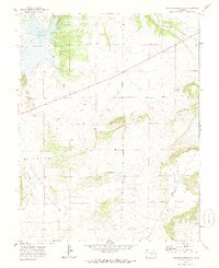
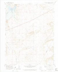
Cucharas Reservoir dominates the northwestern corner of this 1970 landscape, where the Cucharas River cuts through the high plains of southern Colorado. The terrain transition is sharp, moving from the open expanse of Bustos Flat toward the complex drainages of Rattlesnake Canyon in the northeast. This advance proof captures the area's hydrology and land management just before the mid-1970s, highlighting scattered water sources such as Mud Spring and various tanks essential for ranching. The map also delineates the high-altitude boundary between Huerfano Co and Las Animas Co, providing a clear view of the regional topography and surveying benchmarks like BM 6074 and WM 5956 used to document this portion of the Colorado backcountry.
Find a feature on this map
9 named features on this map. Tap any name to fly to it.
Don’t see what you’re looking for? This feature index may not catch every label — zoom into the map to look around manually.
Map Details
Editions of this 1970 Cucharas Reservoir Map
3 editions found
Other maps of this area

1891 · Walsenburg
USGS Topo · 1:125,000

1891 · Apishapa
USGS Topo · 1:125,000

1893 · Apishapa
USGS Topo · 1:125,000

1894 · Walsenburg
USGS Topo · 1:125,000

1897 · Walsenburg
USGS Topo · 1:125,000

1897 · Apishapa
USGS Topo · 1:125,000

1900 · Walsenburg
USGS Topo · 1:125,000

1954 · Trinidad
USGS Topo · 1:250,000

1955 · Trinidad
USGS Topo · 1:250,000

1958 · Trinidad
USGS Topo · 1:250,000