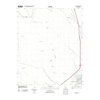
2010 Map of Cuchillo
USGS Topo · Published 2010About this map
Truth or Consequences anchors the southeastern corner of this arid landscape, characterized by its renowned Truth or Consequences Thermal Area and industrial activity at Dredge Tailings Three. To the northwest, the small settlement of Cuchillo sits along the Cuchillo Negro Creek, housing the Cuchillo Post Office. The central terrain is dominated by the Mud Springs Mountains, a region marked by significant mining history. This legacy is evidenced by several named claims and sites, including the Lucky Strike Mine, the Equator and Iron Reef Group, and the Black Chief Claims Black Chief. Cattle ranching and water management are visible through numerous stock tanks, such as Pendergrass Tank and Cantrell Tank Number 1, which dot the drainages of Cañon de la Plata and Yaple Canyon.
Find a feature on this map
33 named features on this map. Tap any name to fly to it.
Don’t see what you’re looking for? This feature index may not catch every label — zoom into the map to look around manually.
Map Details
Editions of this 2010 Cuchillo Map
This is the sole edition of this map. No revisions or reprints were ever made.
Other maps of this area

1954 · Tularosa
USGS Topo · 1:250,000

1958 · Tularosa
USGS Topo · 1:250,000

1958 · Elephant Butte
USGS Topo · 1:24,000

1959 · Engle
USGS Topo · 1:62,500

1961 · Priest Tank
USGS Topo · 1:24,000

1961 · Huerfano Hill
USGS Topo · 1:24,000

1961 · Saladone Tank
USGS Topo · 1:24,000

1961 · Black Bluffs
USGS Topo · 1:24,000

1961 · Williamsburg NW
USGS Topo · 1:24,000

1961 · Williamsburg
USGS Topo · 1:24,000