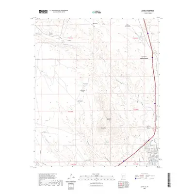
2023 Map of Cuchillo
USGS Topo · Published 2023About this map
Truth or Consequences serves as the dominant hub on this Sierra County survey, where the street grid expands westward toward the foothills of the Mud Springs Mountains. This modern record reveals the urban footprint of the county seat, including the Sierra County Courthouse and the Truth or Consequences Municipal Airport to the north. In contrast to the developed townsite, the western portion of the map remains defined by the winding course of Cuchillo-Negro Creek and the small, established settlement of Cuchillo. For genealogists, the map preserves the locations of local burial grounds such as Vista Memory Gardens and the Cuchillo Cem. The landscape is etched with numerous named arroyos and water catchments, including Yaple Canyon, Willow Spring Draw, and Pendergrass Tank, which illustrate the drainage patterns essential to this arid New Mexico region.
Find a feature on this map
69 named features on this map. Tap any name to fly to it.
Don’t see what you’re looking for? This feature index may not catch every label — zoom into the map to look around manually.
Map Details
Editions of this 2023 Cuchillo Map
This is the sole edition of this map. No revisions or reprints were ever made.
Other maps of this area

1954 · Tularosa
USGS Topo · 1:250,000

1958 · Tularosa
USGS Topo · 1:250,000

1958 · Elephant Butte
USGS Topo · 1:24,000

1959 · Engle
USGS Topo · 1:62,500

1961 · Priest Tank
USGS Topo · 1:24,000

1961 · Huerfano Hill
USGS Topo · 1:24,000

1961 · Saladone Tank
USGS Topo · 1:24,000

1961 · Black Bluffs
USGS Topo · 1:24,000

1961 · Williamsburg NW
USGS Topo · 1:24,000

1961 · Williamsburg
USGS Topo · 1:24,000