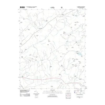
2011 Map of Culberson
USGS Topo · Published 2011About this map
The Nottely River winds through this North Carolina-Georgia borderland, where several small settlements and family milling sites are distributed among the ridges. Culberson serves as a focal point in the north, while the southern landscape is defined by the community of Hemp and the winding course of Hemptown Creek. The area is notably dense with localized milling history, evidenced by Thomas Mill, Wright Mill, Forge Mill, and Sparks Mill, indicating a legacy of small-scale industry along the various mountain branches. For genealogists, the map preserves the locations of numerous historic burial grounds, including Jerusalem Cemetery and Paris Cemetery. The eastern portion of the quadrangle includes the Robert W Woodruff Scout Reservation near Lake Woodruff, illustrating the transition from early settlement patterns to mid-century recreational land use.
Find a feature on this map
148 named features on this map. Tap any name to fly to it.
Don’t see what you’re looking for? This feature index may not catch every label — zoom into the map to look around manually.
Map Details
Editions of this 2011 Culberson Map
This is the sole edition of this map. No revisions or reprints were ever made.
Other maps of this area

1888 · Ellijay
USGS Topo · 1:125,000

1892 · Ellijay
USGS Topo · 1:125,000

1893 · Murphy
USGS Topo · 1:125,000

1898 · Ellijay
USGS Topo · 1:125,000

1911 · Ellijay
USGS Topo · 1:125,000

1914 · Murphy
USGS Topo · 1:125,000

1934 · Murphy
USGS Topo · 1:24,000

1934 · Persimmon Creek
USGS Topo · 1:24,000

1934 · Murphy
USGS Topo · 1:48,000

1935 · Ivylog
USGS Topo · 1:24,000