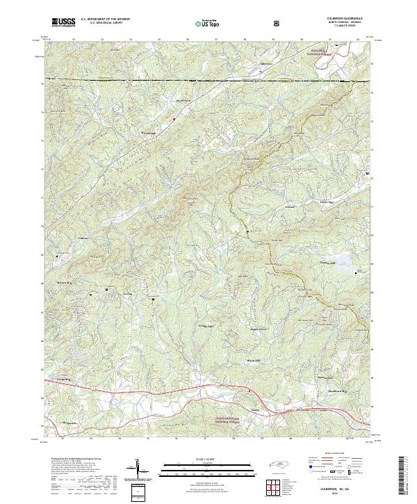
2022 Map of Culberson
USGS Topo · Published 2022About this map
Nottely River flows across the northern reaches of this borderlands terrain where North Carolina and Georgia meet. The landscape is defined by its deep milling history, with settlements such as Wright Mill, Thomas Mill, Brown Mill, and Sparks Mill following the courses of Hemptown Cr and Cutcane Cr. The terrain is partitioned by several prominent ridges including Dividing Ridge and Cutcane Ridge, which served as natural barriers for early settlers in the areas of Loving and Cutcane.
Find a feature on this map
78 named features on this map. Tap any name to fly to it.
Don’t see what you’re looking for? This feature index may not catch every label — zoom into the map to look around manually.
Map Details
Editions of this 2022 Culberson Map
This is the sole edition of this map. No revisions or reprints were ever made.
Other maps of this area

1888 · Ellijay
USGS Topo · 1:125,000

1892 · Ellijay
USGS Topo · 1:125,000

1893 · Murphy
USGS Topo · 1:125,000

1898 · Ellijay
USGS Topo · 1:125,000

1911 · Ellijay
USGS Topo · 1:125,000

1914 · Murphy
USGS Topo · 1:125,000

1934 · Murphy
USGS Topo · 1:24,000

1934 · Persimmon Creek
USGS Topo · 1:24,000

1934 · Murphy
USGS Topo · 1:48,000

1935 · Ivylog
USGS Topo · 1:24,000