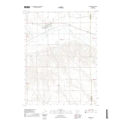
2017 Map of Culbertson
USGS Topo · Published 2017About this map
Culbertson serves as the focal point of this southwestern Nebraska landscape, situated near the confluence of Frenchman Creek and the Republican River. The area’s character is defined by an extensive network of water management infrastructure essential for High Plains agriculture. A complex system of irrigation channels, including the Culbertson Canal, Meeker Canal, and Riverside Canal, winds across the terrain to support local farming operations. To the south, the topography transitions into more dissected hills, where several catchments such as Kugler Reservoir, Hoyt Reservoir, and Korell Reservoir are located. This 2017 survey details the intersection of these vital waterways with a regular grid of county roads and local streets like Kleven Ave and Tate Ave, illustrating how the town’s layout and the surrounding rural landscape are inextricably linked to the management of the river valley's resources.
Find a feature on this map
49 named features on this map. Tap any name to fly to it.
Don’t see what you’re looking for? This feature index may not catch every label — zoom into the map to look around manually.
Map Details
Editions of this 2017 Culbertson Map
This is the sole edition of this map. No revisions or reprints were ever made.
Other maps of this area

1954 · McCook
USGS Topo · 1:250,000

1957 · McCook
USGS Topo · 1:250,000

1957 · McCook SW
USGS Topo · 1:24,000

1958 · McCook
USGS Topo · 1:250,000

1962 · Culbertson NW
USGS Topo · 1:24,000

1962 · Culbertson SW
USGS Topo · 1:24,000

1970 · Red Willow Dam
USGS Topo · 1:24,000
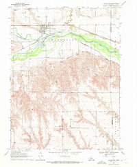
1970 · Culbertson
USGS Topo · 1:24,000

1970 · McCook West
USGS Topo · 1:24,000

1970 · Burger Canyon SE
USGS Topo · 1:24,000