
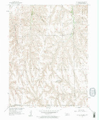
1957 Map of McCook SW
USGS Topo · Published 1958About this map
Driftwood Cr and its tributaries carve a complex drainage pattern across this high-plains landscape on the Nebraska-Kansas border. Published in the late 1950s as part of the Missouri River Basin development program, the map captures a rural transition zone where the Richland and Grant precincts meet the state line. The settlement pattern is defined by isolated rural schoolhouses, such as Banksville Sch and the evocatively named Devils Gap Sch, which served as vital community hubs for the surrounding farmsteads. Deep incisions like Cottonwood Canyon and the Valley Range break the plateau, while numerous ephemeral waterways including Plum Creek, Spring Creek, and Dry Creek suggest a terrain heavily influenced by seasonal runoff and local erosion patterns in the Finley and Driftwood areas.
Find a feature on this map
14 named features on this map. Tap any name to fly to it.
Don’t see what you’re looking for? This feature index may not catch every label — zoom into the map to look around manually.
Map Details
Editions of this 1957 McCook SW Map
2 editions found
Other maps of this area

1951 · Herndon
USGS Topo · 1:62,500

1951 · Oberlin
USGS Topo · 1:62,500

1954 · McCook
USGS Topo · 1:250,000

1954 · Goodland
USGS Topo · 1:250,000

1956 · Goodland
USGS Topo · 1:250,000

1957 · McCook
USGS Topo · 1:250,000

1957 · Goodland
USGS Topo · 1:250,000

1957 · McCook SE
USGS Topo · 1:24,000

1958 · McCook
USGS Topo · 1:250,000
1970 · Culbertson
USGS Topo · 1:24,000