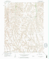
1957 Map of McCook SW
USGS Topo · Published 1958About this map
The rugged drainage basins of Driftwood Creek and its tributaries define this 1957 landscape straddling the Nebraska-Kansas border. The terrain is characterized by deep incisions like Cottonwood Canyon and Plum Creek, which cut through the high plains topography of Richland and Grant townships. This survey captures a rural landscape where the placement of schoolhouses reflects the distributed settlement patterns of the mid-20th century. Banksville Sch and Devils Gap Sch serve as the primary social landmarks in a region largely defined by its natural watercourses and canyons. The Base Line serves as a prominent surveying boundary, anchoring the transition between Red Willow County and the northern border of Kansas. The map provides a clear look at the network of unimproved roads and light-duty paths that once connected these isolated farmsteads and rural schools before the expansion of modern highway systems.
Find a feature on this map
18 named features on this map. Tap any name to fly to it.
Don’t see what you’re looking for? This feature index may not catch every label — zoom into the map to look around manually.
Map Details
Editions of this 1957 McCook SW Map
2 editions found
Other maps of this area

1951 · Herndon
USGS Topo · 1:62,500

1951 · Oberlin
USGS Topo · 1:62,500

1954 · McCook
USGS Topo · 1:250,000

1954 · Goodland
USGS Topo · 1:250,000

1956 · Goodland
USGS Topo · 1:250,000

1957 · McCook
USGS Topo · 1:250,000

1957 · Goodland
USGS Topo · 1:250,000

1957 · McCook SW
USGS Topo · 1:24,000

1957 · McCook SE
USGS Topo · 1:24,000

1958 · McCook
USGS Topo · 1:250,000