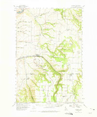
1958 Map of Culdesac
USGS Topo · Published 1975About this map
St Joseph Mission and the settlement of Slickpoo anchor the southern portion of this mid-century landscape, where the boundary between Nez Perce Co and Lewis Co crosses the high ground of the Camas Prairie. The region is defined by the steep descent from the plateau to the Clearwater River at Myrtle, a transition managed by engineering feats like the Camas Prairie Railroad with its series of Tunnels.
Find a feature on this map
83 named features on this map. Tap any name to fly to it.
Don’t see what you’re looking for? This feature index may not catch every label — zoom into the map to look around manually.
Map Details
Editions of this 1958 Culdesac Map
2 editions found
Other maps of this area

1924 · Kamiah
USGS Topo · 1:125,000

1946 · Limekiln Rapids
USGS Topo · 1:62,500

1955 · Pullman
USGS Topo · 1:250,000

1958 · Pullman
USGS Topo · 1:250,000

1958 · Lapwai
USGS Topo · 1:24,000

1958 · Sweetwater
USGS Topo · 1:24,000

1958 · Lewiston Orchards
USGS Topo · 1:62,500

1958 · Culdesac
USGS Topo · 1:62,500

1961 · Kendrick
USGS Topo · 1:62,500

1961 · Ahsahka
USGS Topo · 1:62,500