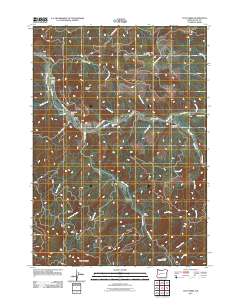
2011 Map of Culp Creek
USGS Topo · Published 2011About this map
Row River and its numerous tributaries, including Sharps Creek, Layng Creek, and Brice Creek, define the topography of this Lane County corridor in the early 21st century. The landscape is characterized by narrow valleys and significant elevations such as Green Mountain and Hawley Butte. Small rural hubs like Dorena and Culp Creek are identified by their respective post offices, serving as focal points for the surrounding timber and mountain terrain. Notable landmarks like Wildwood Falls and the Staples Covered Bridge near Lick Creek reflect the area's geography and infrastructure. The map details a network of forest and mountain roads, including Booth Kelly Camp Rd and Green Mountain Rd, which provide access to the high ground above the river forks. This survey provides a precise record of these mountain settlements and their relationship to the complex watershed of the southern Willamette Valley foothills.
Find a feature on this map
40 named features on this map. Tap any name to fly to it.
Don’t see what you’re looking for? This feature index may not catch every label — zoom into the map to look around manually.
Map Details
Editions of this 2011 Culp Creek Map
This is the sole edition of this map. No revisions or reprints were ever made.
Other maps of this area

1935 · Lowell
USGS Topo · 1:96,000

1942 · Lowell
USGS Topo · 1:125,000

1955 · Hardesty Mtn
USGS Topo · 1:62,500

1955 · Fairview Peak
USGS Topo · 1:62,500

1955 · Culp Creek
USGS Topo · 1:62,500

1955 · Lowell
USGS Topo · 1:62,500

1958 · Roseburg
USGS Topo · 1:250,000

1959 · Roseburg
USGS Topo · 1:250,000

1983 · Oakridge
USGS Topo · 1:100,000
1986 · Blue Mountain
USGS Topo · 1:24,000