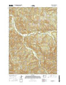
2017 Map of Culp Creek
USGS Topo · Published 2017About this map
Row River flows through the heart of this landscape, connecting the small logging and river settlements of Dorena, Culp Creek, and Disston. The terrain is defined by significant elevations such as Green Mtn and Hawley Butte, with a dense network of forest service and resource roads like Green Mountain Rd and Sharps Creek Rd providing access to the steep drainage basins. Along Sharps Cr, the presence of Pony Bridge and Staples Covered Bridge highlights the historical engineering required to navigate the area's many tributaries, including Layng Creek and Brice Cr. The inclusion of Wildwood Falls on the Row River suggests a landscape where natural landmarks and industrial access routes have long coexisted. For those tracing the geography of the Cascades foothills, the map details the intricate relationship between the waterway and the local infrastructure that supports these mountain communities.
Find a feature on this map
48 named features on this map. Tap any name to fly to it.
Don’t see what you’re looking for? This feature index may not catch every label — zoom into the map to look around manually.
Map Details
Editions of this 2017 Culp Creek Map
This is the sole edition of this map. No revisions or reprints were ever made.
Other maps of this area

1935 · Lowell
USGS Topo · 1:96,000

1942 · Lowell
USGS Topo · 1:125,000

1955 · Hardesty Mtn
USGS Topo · 1:62,500

1955 · Fairview Peak
USGS Topo · 1:62,500

1955 · Culp Creek
USGS Topo · 1:62,500

1955 · Lowell
USGS Topo · 1:62,500

1958 · Roseburg
USGS Topo · 1:250,000

1959 · Roseburg
USGS Topo · 1:250,000

1983 · Oakridge
USGS Topo · 1:100,000
1986 · Blue Mountain
USGS Topo · 1:24,000