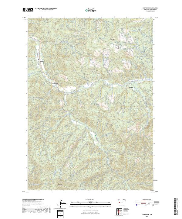
2024 Map of Culp Creek
USGS Topo · Published 2024About this map
The Row River corridor defines this portion of Lane County, where the historic communities of Dorena, Culp Creek, and Disston sit along the valley floor. These settlements, linked by Row River Rd and the Row River Trail-Asphalt Trl, reflect a landscape shaped by the timber and mining economies of the Cascade foothills. The terrain rises sharply from the riverbanks toward prominent summits like Hawley Butte and Green Mtn, while Wildwood Falls marks a notable hydraulic feature on the eastern edge of the quadrangle.
Find a feature on this map
45 named features on this map. Tap any name to fly to it.
Don’t see what you’re looking for? This feature index may not catch every label — zoom into the map to look around manually.
Map Details
Editions of this 2024 Culp Creek Map
This is the sole edition of this map. No revisions or reprints were ever made.
Other maps of this area

1935 · Lowell
USGS Topo · 1:96,000

1942 · Lowell
USGS Topo · 1:125,000

1955 · Hardesty Mtn
USGS Topo · 1:62,500

1955 · Fairview Peak
USGS Topo · 1:62,500

1955 · Culp Creek
USGS Topo · 1:62,500

1955 · Lowell
USGS Topo · 1:62,500

1958 · Roseburg
USGS Topo · 1:250,000

1959 · Roseburg
USGS Topo · 1:250,000

1983 · Oakridge
USGS Topo · 1:100,000
1986 · Blue Mountain
USGS Topo · 1:24,000