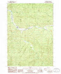
1986 Map of Culp Creek
USGS Topo · Published 1986About this map
The Row River corridor defines the geography of this mid-1980s survey, anchoring the small settlements of Dorena, Culp Creek, and Disston. This logging and recreation landscape is marked by the winding river valley and its many tributaries, including Sharps Creek and Brice Creek. Local genealogy and land-use history are evident in features like the Cem near the river and the Dorena Station, while industrial activity is noted by several Quarry sites throughout the hills.
Find a feature on this map
34 named features on this map. Tap any name to fly to it.
Don’t see what you’re looking for? This feature index may not catch every label — zoom into the map to look around manually.
Map Details
Editions of this 1986 Culp Creek Map
This is the sole edition of this map. No revisions or reprints were ever made.
Other maps of this area

1935 · Lowell
USGS Topo · 1:96,000

1942 · Lowell
USGS Topo · 1:125,000

1955 · Hardesty Mtn
USGS Topo · 1:62,500

1955 · Fairview Peak
USGS Topo · 1:62,500

1955 · Culp Creek
USGS Topo · 1:62,500

1955 · Lowell
USGS Topo · 1:62,500

1958 · Roseburg
USGS Topo · 1:250,000

1959 · Roseburg
USGS Topo · 1:250,000

1983 · Oakridge
USGS Topo · 1:100,000
1986 · Blue Mountain
USGS Topo · 1:24,000