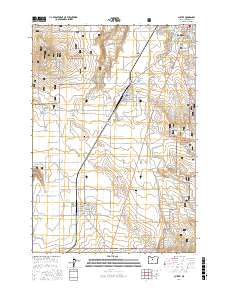
2017 Map of Culver
USGS Topo · Published 2017About this map
Madras, Metolius, and Culver anchor this high desert landscape, forming a corridor of settlements along the highway and rail lines in Jefferson County. The terrain is defined by the sharp incision of the Crooked River Gorge and the broad expanses of the Little Agency Plains and Crooked River National Grassland. These features suggest a region shaped by volcanic geology and agricultural development, where the flat mesas of Round Butte and the depth of Dry Canyon dictate the placement of roads and towns.
Find a feature on this map
61 named features on this map. Tap any name to fly to it.
Don’t see what you’re looking for? This feature index may not catch every label — zoom into the map to look around manually.
Map Details
Editions of this 2017 Culver Map
This is the sole edition of this map. No revisions or reprints were ever made.
Other maps of this area

1926 · Bend
USGS Topo · 1:125,000

1928 · Madras
USGS Topo · 1:125,000

1929 · Bend
USGS Topo · 1:125,000

1931 · Madras
USGS Topo · 1:125,000

1955 · Bend
USGS Topo · 1:250,000

1957 · Bend
USGS Topo · 1:250,000

1958 · Bend
USGS Topo · 1:250,000

1962 · Opal City
USGS Topo · 1:24,000
1962 · Gray Butte
USGS Topo · 1:24,000
1962 · Steelhead Falls
USGS Topo · 1:24,000