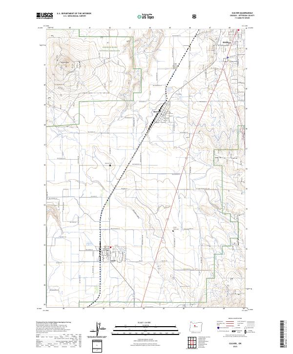
2023 Map of Culver
USGS Topo · Published 2023About this map
The agricultural and high-desert landscapes of Jefferson County are anchored by the three principal settlements of Madras, Metolius, and Culver along the central corridor. This 2023 survey illustrates the distinct transition from the irrigated tracts of the Little Agency Plains to the protected expanse of the Crooked River National Grassland in the west. Topographical highlights include the prominent Round Butte and the winding course of Dry Canyon, which mark the rugged geography bordering the Deschutes River basin.
Find a feature on this map
68 named features on this map. Tap any name to fly to it.
Don’t see what you’re looking for? This feature index may not catch every label — zoom into the map to look around manually.
Map Details
Editions of this 2023 Culver Map
This is the sole edition of this map. No revisions or reprints were ever made.
Other maps of this area

1926 · Bend
USGS Topo · 1:125,000

1928 · Madras
USGS Topo · 1:125,000

1929 · Bend
USGS Topo · 1:125,000

1931 · Madras
USGS Topo · 1:125,000

1955 · Bend
USGS Topo · 1:250,000

1957 · Bend
USGS Topo · 1:250,000

1958 · Bend
USGS Topo · 1:250,000

1962 · Opal City
USGS Topo · 1:24,000
1962 · Gray Butte
USGS Topo · 1:24,000
1962 · Steelhead Falls
USGS Topo · 1:24,000