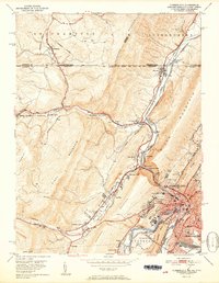
1951 Map of Cumberland
USGS Topo · Published 1951About this map
Cumberland serves as the focal point of this 1951 survey, situated at the confluence of Wills Creek and the North Branch Potomac River. The city is a dense hub of industrial infrastructure, where the Baltimore and Ohio, Western Maryland, and Cumberland and Pennsylvania railroads converge amidst a landscape of steep ridges and narrow gaps. Significant landmarks like the Courthouse, City Hall, and Allegany High School anchor the urban core, while the surrounding terrain is defined by dramatic geology at The Narrows and Lovers Leap.
Find a feature on this map
70 named features on this map. Tap any name to fly to it.
Don’t see what you’re looking for? This feature index may not catch every label — zoom into the map to look around manually.
Map Details
Editions of this 1951 Cumberland Map
3 editions found
Other maps of this area

1898 · Frostburg
USGS Topo · 1:62,500

1899 · Flintstone
USGS Topo · 1:62,500

1900 · Flintstone
USGS Topo · 1:62,500

1901 · Frostburg
USGS Topo · 1:62,500

1908 · Frostburg
USGS Topo · 1:62,500

1923 · Berlin
USGS Topo · 1:48,000

1927 · Hyndman
USGS Topo · 1:62,500

1929 · Berlin
USGS Topo · 1:62,500

1931 · Hyndman
USGS Topo · 1:62,500

1944 · Hyndman
USGS Topo · 1:62,500