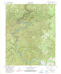
1979 Map of Cumberland Falls
USGS Topo · Published 1989About this map
Cumberland River carves a deep, winding path through the heart of the Daniel Boone National Forest in this late 1970s survey. The landscape is defined by its dramatic hydrology, featuring the celebrated Cumberland Falls State Resort Park and treacherous river features like Thunderstruck Shoals, Slick Shoals, and Bee Shoals. Human activity is concentrated along the ridges and near the water, visible in the scattered settlements of Honeybee and New Liberty.
Find a feature on this map
46 named features on this map. Tap any name to fly to it.
Don’t see what you’re looking for? This feature index may not catch every label — zoom into the map to look around manually.
Map Details
Editions of this 1979 Cumberland Falls Map
2 editions found
Other maps of this area

1890 · Williamsburg
USGS Topo · 1:125,000

1894 · Williamsburg
USGS Topo · 1:125,000

1952 · Wofford
USGS Topo · 1:24,000

1952 · Hail
USGS Topo · 1:24,000

1952 · Vox
USGS Topo · 1:24,000

1952 · Hollyhill
USGS Topo · 1:24,000

1952 · Wiborg
USGS Topo · 1:24,000

1952 · Cumberland Falls
USGS Topo · 1:24,000

1952 · Williamsburg
USGS Topo · 1:24,000

1952 · Whitley City
USGS Topo · 1:24,000